SUMMARY INFORMATION IN RESPECT OF COTE GOLD PROJECT, ONTARIO, CANADA
Unless stated otherwise, the information in this summary is based upon the technical report (the "Côté Gold Report") entitled "Technical Report on the Côté Gold Project, Ontario, Canada, Report for NI 43-101", prepared by SLR Consulting (Canada) Ltd. ("SLR") and authored by current or former employees of SLR (being Jason J. Cox, Tudorel Ciuculescu and Stephen Theben), as well as by Wood Canada Limited ("Wood") and authored by current or former employees of Wood (being Adam Coulson, Bijal Shah, Mickey M. Davachi, Paul O'Hara, Raymond J. Turenne , Sheila E. Daniel and Deena Nada), as well as by Marie-France Bugnon and Alan R. Smith of IAMGOLD Corporation ("IAMGOLD" or the "Corporation"), with an effective date of June 30, 2022. Portions of the following information are based on assumptions, qualifications and procedures, which are not fully described herein. Reference should be made to the full text of the Côté Gold Report, which is available for review on the Corporation's issuer profile on SEDAR at www.sedar.com and EDGAR at www.sec.gov.
i) Property Description, Location and Access
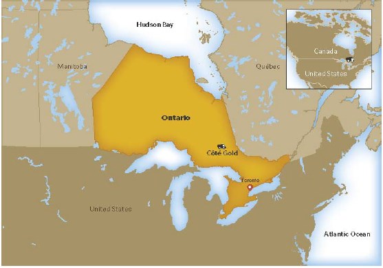
The Côté Gold Project is located in the Porcupine Mining Division, 20 kilometres southwest of Gogama, Ontario, and extends approximately 73 kilometres from Esther Township in the west to Londonderry Township in the east. The Côté Gold Project comprises a group of properties assembled through staking and option agreements covering a total area of about 596 square kilometres. The Côté Gold Project mining leases area forms a portion of the overall claim area.
-2-
The Côté Gold Project is bisected by Highway 144 and is about 175 kilometres by road north of Sudbury via Highway 144 and 125 kilometres southwest of Timmins via Highways 101 and 144.
The original Chester exploration property is located in the central portion of the mining leases area, which hosts the Côté and Gosselin deposits, as well as the Chester 1 zone and several other gold occurrences. IAMGOLD holds a significant land package which adequately covers the Côté Gold Project and area outside the Côté Gold Project mining leases. Overall, the Côté Gold Project's property package consists of 2,976 tenures covering a surface area of approximately 59,591 ha (or 595.91 square kilometres).
On April 27, 2012, IAMGOLD announced that it had entered into a definitive agreement with Trelawney to acquire, through a wholly owned subsidiary, all the issued and outstanding common shares of Trelawney through a plan of arrangement (the "Trelawney Transaction"). On June 21, 2012, IAMGOLD announced the acquisition of all issued and outstanding common shares of Trelawney, which were subsequently delisted. TAAC, a subsidiary of Trelawney at the time of the Trelawney Transaction, became an indirectly wholly owned IAMGOLD subsidiary.
Following an amalgamation on June 1, 2017, all of IAMGOLD's interests in the groups of properties comprising the Côté Gold Project are now owned by and registered in the name of IAMGOLD, with the exception of the 986813 Ontario property, which is held in the name of 986813 Ontario, an IAMGOLD subsidiary.
On June 20, 2017, IAMGOLD completed a transaction with SMM wherein SMM agreed to acquire a 30% undivided participating joint venture interest in the IAMGOLD's interest in the Côté Gold Project property package. SMM's interest in the Côté Gold Project is held by the SMM subsidiary SMM Gold Côté Inc.
The properties acquired through the Trelawney Transaction were the result of a number of agreements with third parties. These third parties may retain an interest in some of the properties within the Côté Gold Project's property package either by way of an actual property interest or through royalty interests.
IAMGOLD has regularly completed assessment work to maintain the claims in good standing.
Please see Section 4 of the Côté Gold Report for a detailed description of the terms of any royalties and other agreements to which the Côté Gold Project is subject, as well as the tenure and expiration dates of the claims, licenses and other property tenure rights.
IAMGOLD is not aware of any environmental liabilities associated with or attributable to any of the subject property groups in the Côté Gold Project area, other than those that would normally be expected as a result of historical mining activities and associated mine workings.
Legacy diamond drill site remediation took place from 2013 to 2018 with 186 legacy drill sites remediated. This work comprised removal of historic debris, capping of drill casings, and attaching a marker flag to the casing.
-3-
A program of drill collar decommissioning took place between 2019 and 2020 in areas of planned Côté Gold Project infrastructure. These drill holes were grouted to prevent ground water flow and the casings were removed.
IAMGOLD is not aware of any other risks that could affect access, title or its ownership interests in, or the right or ability to perform work on the Côté Gold Project.
ii) History
Prospecting and exploration activity in the Côté Gold Project area began circa 1900 and has continued sporadically to the present, spurred on periodically from exploration in the Porcupine and Elk Lake- Gowganda-Shiningtree camps. The first discovery of note was the Lawrence copper prospect on the east shore of Mesomikenda Lake in 1910. Further interest in the area was sparked in 1930 when Alfred Gosselin found outcropping gold mineralization on the east shore of Three Duck Lakes.
Historical work on the Côté Gold Project's property package has been conducted in multiple stages:
• In the early 1940s extensive prospecting and trenching was conducted, in addition to the sinking of several shallow shafts and some minor production.
• Through to the late 1960s little or no work was performed.
• From the early 1970s to approximately 1990, extensive surface work was performed, in addition to some limited underground investigations.
• From 1990 to 2009, fragmented property ownership precluded any major programs.
• In 2009, a group of properties that became the Chester property was consolidated by Trelawney.
A significant number of gold showings have been discovered on the Côté Gold Project's property package. Please see Section 6 of the Côté Gold Report for a detailed description of the history of the exploration and development at the Côté Gold Project.
iii) Geological Setting, Mineralization and Deposit Types
The Côté and Gosselin deposits are located in the Swayze greenstone belt in the southwestern extension of the Abitibi greenstone belt of the Superior Province. The Abitibi Subprovince comprises Late Archean metavolcanic rocks, related synvolcanic intrusions, and clastic metasedimentary rocks, intruded by Archean alkaline intrusions and Paleoproterozoic diabase dykes. The traditional Abitibi greenstone belt stratigraphic model envisages lithostratigraphic units deposited in autochthonous successions, with their current complex map pattern distribution developed through the interplay of multiphase folding and faulting.
The Swayze greenstone belt, like the rest of the Abitibi greenstone belt, contains extrusive and intrusive rock types ranging from ultramafic through felsic in composition, as well as both chemical and clastic sedimentary rocks. All of the rock types within the Swayze belt are older than 2,680 Ma, with the oldest dating 2,748.2 Ma. Igneous lithologies predominate and include both volcanic and plutonic rocks. The latter are observed both internally in the supracrustal belts and externally, in large granitoid complexes. Sedimentary rocks occur predominantly near the top of the succession.
-4-
The Swayze greenstone belt underwent a complex and protracted structural history of polyphase folding, development of multiple foliations, ductile high strain zones, and late brittle faulting. The map pattern preserved within the Swayze greenstone belt is dominated by regional F2 folding, and anticlines and synclines with an associated S2 axial-planar foliation interpreted to have formed during orogen-wide shortening across the entire Superior Province. An important structural element is the RDZ, a major east- west high strain zone that is interpreted to be the western extension of the Larder Lake-Cadillac deformation zone of the Abitibi greenstone belt. The F2 Ridout Synform coincides with the RDZ wherein intense deformation is characterized by intense flattening, tight to isoclinal folding, transposition, and locally a component of dextral simple shear in east-southeast-striking zones. Metamorphic grade within the southern Abitibi greenstone belt ranges from sub-greenschist to greenschist.
The Côté and Gosselin deposits are situated within the Chester Township area, which overlies a narrow greenstone belt assemblage that extends easterly from the southeast corner of the Swayze greenstone belt to the Shining Tree area, approximately 60 kilometres to the east. The greenstone (supracrustal) assemblage is part of the well-defined Ridout syncline that separates the Kenogamissi granitoid complex to the north from the Ramsey-Algoma granitoid complex to the south. The Kenogamissi complex, yielding ages of 2,747 Ma, consists of sheet-like dioritic and tonalitic intrusions, which are interpreted locally to be synvolcanic. The CIC, which hosts the Côté and Gosselin deposits, is also synvolcanic and was emplaced along what is now the southern margin of the Ridout syncline. The CIC is a crudely stratified tonalite-diorite- quartz diorite laccolith containing numerous screens and inclusions of mafic volcanic rocks.
The Côté and Gosselin deposits are located with 1.5 kilometres of each other and are both hosted by the CIC. The deposits are similar in geological composition with a few key differences in terms of breccia rocks and alteration. Both deposits are centred on magmatic and hydrothermal breccia bodies that intrude tonalitic and dioritic rocks. The CIC intruded into the mafic volcanic rocks of the Arbutus Formation, which forms the basal formation in the Chester Group. The formation consists of low potassium tholeiitic pillow basalts, mafic flows, and sills. The intrusive host rocks formed from a number of pulses of several distinct and evolving dioritic and tonalitic magmas that display complex crosscutting relationships.
The Côté and Gosselin deposit type gold mineralization consists of low to moderate grade gold (±copper) mineralization associated with brecciated and altered tonalite and diorite rocks.
Several styles of gold mineralization are recognized within the deposit, and include disseminated, breccia hosted and vein type, all of which are co-spatial with biotite (± chlorite), sericite and for the Côté deposit silica-sodic alteration.
Disseminated mineralization in the hydrothermal matrix of the breccia is the most important style of gold (±copper) mineralization. This style consists of disseminated pyrite, chalcopyrite, pyrrhotite, magnetite, gold (often in native form), and molybdenite in the matrix of the breccia and is associated with primary hydrothermal biotite and chlorite after biotite.
-5-
Other mineralization styles that have been identified within the Côté Gold Project area include orogenic or structurally-hosted vein occurrences, and syenite intrusion-related gold zones. The syenite intrusion-related gold zones are considered attractive exploration targets.
The Côté Gold Project deposit is a new Archean low grade, high tonnage gold (± copper) discovery. It is described as a synvolcanic intrusion related and stockwork disseminated gold deposit. Deposits of this type are commonly spatially associated with and/or hosted in intrusive rocks. They include porphyry copper-gold, syenite associated disseminated gold and reduced gold-bismuth-tellurium-tungsten intrusion related deposits, as well as stockwork disseminated gold.
Certain features of the Côté deposit resemble those characteristic of gold rich porphyry deposits. These include:
• Emplacement at shallow (one to two kilometres) crustal levels, frequently associated with coeval volcanic rocks.
• Localized by major fault zones, although many deposits show only relatively minor structures in their immediate vicinities.
• Hydrothermal breccias are commonly associated with the deposits and consist of early orthomagmatic as well as later phreatic and phreatomagmatic breccias.
• Gold is fine grained, commonly <20 micrometres, generally <100 micrometres, and is closely associated with iron and copper-iron sulphides (pyrite, bornite, chalcopyrite).
• The Gosselin deposit, similar to the Côté deposit, is also hosted in the synvolcanic CIC and most of its mineralization lies within hydrothermal breccia, diorite breccia, and tonalite units. Both the Gosselin deposit and the Côté deposit are classified as intrusion related disseminated gold deposits. Preliminary investigations completed on host breccias of the Côté deposit and the Gosselin deposit reveal that the Gosselin breccias resulted from fracturing and infiltration of fluids via fractures and veins. It is postulated that the combination of fracturing and fluid infiltration resulted in intense alteration through extensive fluid wall rock interaction, resulting in the formation of the breccia type appearance. Observations from the Gosselin deposit drill core reveal a spatial distribution of gold grades with increasing sericite alteration and associated with narrow quartz-carbonate-biotite-chlorite-pyrrhotite ± pyrite±chalcopyrite veins. Further work is planned to assess the detailed mineralogy and petrogenesis of the Gosselin deposit.
iv) Exploration
The Côté Gold Project area is divided into three sectors for exploration purposes: (i) South Swayze West (western area), (ii) Chester (central area), and (iii) South Swayze East (eastern area).
Exploration programs to date have identified the Côté and the Gosselin deposits and have evaluated several nearby gold showings for their potential to be bulk-mineable gold deposits. Gold zones situated near the Côté and Gosselin deposits remain prospective for additional bulk-tonnage gold mineralization, and active exploration programs will continue to evaluate these targets.
-6-
Exploration programs to date have been sufficient to screen many areas for the presence of a Côté-style deposit, with grid line spacing and general traverse spacing of <200 metres (some areas <100 metres spacing for traverse/grid line density). Litho-sampling and geological mapping is representative over much of the land holdings within the Côté Gold Project, with some exceptions where glacial till and lacustrine deposits form thick mantles on the bedrock. In areas of thick overburden, IP geophysical surveys and diamond drilling has helped screen these areas.
General results and conclusions from ongoing exploration work are summarized below by target area:
• South Swayze West: Côté-style tonalite and diorite hosted breccia zones have not been discovered to date. Exploration for syenite intrusion or shear zone hosted gold zones continues. The presence of Timiskaming-style basin sediments cut by porphyry intrusions and broad structural deformation zones provide a good environment for gold bearing vein networks.
• Chester Area: West of the Côté deposit, the discovery of gold mineralization in the HDZ (with associate breccia) reveals some similar host rocks and alteration styles to the Côté deposit. Southwest of the Côté deposit, gold bearing breccia outcrops and sheeted sulphide veins have been mapped along the shoreline of Clam Lake in 2019 and 2020 and this area is considered highly prospective for the occurrence of gold mineralization. Northeast of the Gosselin deposit, gold mineralization occurs in narrow shear zones hosted in diorite and tonalite in the Jack Rabbit area, which also remains prospective for economic gold accumulations.
• South Swayze East: Gold mineralization discovered and investigated to date reveals only narrow and discontinuous shear zone hosted veins. The lack of Côté-style mineralization makes this area less favorable for the discovery of a bulk-tonnage gold zone.
v) Drilling
Côté
Core drilling of the Côté deposit commenced in 2009 and has included various phases of exploration, infill, metallurgical and condemnation drilling. A total of 808 drill holes (327,433 metres) have been completed within the Côté Gold Project deposit area.
Core sizes have included the following: HQ (63.5-millimetre core diameter), NQ (47.6 millimetres), BQ (36.4 millimetres), and BQTW (36 millimetres). For holes drilled on land, the casing was left in place and capped. Holes drilled on lakes were cemented and the casing pulled.
Geologists checked all core boxes upon arrival at the core shack and ensured that no core was missing and any reported drill hole orientation information was provided from the drilling contractor. Technicians made meterage marks and logged rock quality designation (RQD). All core was photographed.
-7-
Geologists completed the core log, recording details of lithology, alteration, mineralization, and structure. The Côté database has core recovery measurements for 179 Trelawney drill holes and 423 IAMGOLD drill holes. Overall, the core recovery from the 2009 to 2019 programs was approximately 99%.
For oriented core, technicians drew the bottom of hole line on the core. A full line was drawn when orientation marks were perfectly aligned. Alpha and beta angles were measured for all veins and contacts when the bottom of the hole line was defined.
The collar azimuths for pre-2017 holes were established using front and back site markers located in the field with compass or GPS instruments. The collars are subsequently re-surveyed post-drilling. L. Labelle Surveys based in Timmins, Ontario has been responsible for collecting the survey measurements for Côté since 2009.
A FlexIT SmartTool instrument was used to collect down hole survey measurements for key index holes drilled between 2009 and 2013. A Reflex EZ-TRAC tool was used to collect down hole survey measurements for holes drilled between 2014 and 2019.
Drilling at Côté is typically oriented perpendicular to the strike of the mineralization. Depending on the dip of the drill hole and the dip of the mineralization, drill intercept widths are typically greater than true widths.
Gosselin
Exploratory diamond drilling at Gosselin was initiated in 2016 and following completion of five drill holes (2016 to 2017) resulted in a significant new discovery. Following the initial drilling period, successive drilling campaigns from 2018 to 2022 have been completed to delineate the Gosselin Mineral Resource and to complete the required in-fill drilling to support an initial Mineral Resource estimate.
Since completion of the initial Gosselin Mineral Resource estimate (effective October 4, 2021), IAMGOLD has been conducting a drilling program focused on evaluating the saddle area between the Côté and Gosselin resource pit shells and testing for extensions of mineralization along strike to the northeast and at depth below the current Gosselin resource pit shell. A total of 4,149 metres (10 holes) of diamond drilling was completed between July 29, 2021 and October 13, 2021, with a further 7,727 metres (18 holes) completed between January 21, 2022 and May 31, 2022 as part of the ongoing drilling program. The results will be incorporated into the Gosselin deposit model for use in future Mineral Resource estimation updates.
A total of 121 drill holes (50,274 metres) have been completed within the Gosselin deposit area. Land and ice- based drill holes were NQ core size (47.6-millimetre core diameter), whereas barge based drill holes were BTW core size (42-millimetre core diameter). Drill rigs employed wireline systems and generally oriented- core drilling techniques. For holes drilled on land, the casing was left in place and capped. Holes drilled on lakes were cemented and the casing pulled. Hole locations were provided to the Côté construction team who are responsible for decommissioning any collars within the mine infrastructure footprint. Decommissioning consists of grouting of the collars with cement followed by removal of the casing and monuments.
-8-
Geologists checked all core boxes upon arrival at the core shack and ensured that no core was missing and any reported drill hole orientation information was provided from the drilling contractor. Technicians made meterage marks and logged RQD. All core was photographed.
Geologists completed the core log, recording details of lithology, alteration, mineralization, and structure. For oriented core, technicians drew the bottom of hole line on the core. A full line was drawn when orientation marks were perfectly aligned. Alpha and beta angles were measured for all veins and contacts when the bottom of hole line was defined.
The Gosselin database has core recovery measurements for all 121 IAMGOLD drill holes. Core recovery is generally very good at an average recovery of 99.5%.
Both land and ice-based drill hole collars were initially positioned using a handheld Garmin 64s GPS with ± three metre accuracy. Prior to drilling on ice and barge-based platforms, Tulloch Geomatics was contracted to further correct the final collar locations using a Trimble R10 GPS receiver in Real Time Kinematic mode (vertical and horizontal accuracy of ± 0.03 metres). Land-based drill hole collars were surveyed by Tulloch Geomatics once drilling was completed.
On land and ice-based drill platforms, the collar azimuths were initially established by IAMGOLD geologists using front and back sight markers with a compass, then further refined with a Reflex North Finder APS (Azimuth Pointing System) tool. The Reflex APS is a GPS based tool that is not affected by local magnetic interference. On barge-based platforms, Tulloch Geomatics was contracted to mark the initial collar locations by placing marker buoys positioned with a Trimble R10 GPS receiver in Real Time Kinematic mode. Reflex APS was used to align the collar azimuths.
A Reflex EZ-TRAC tool was used to collect down hole survey measurements for holes drilled between 2018 and 2022.
The Gosselin deposit mineralization orientation varies in strike and dip locally. Actual core widths are estimated at approximately 60% to 95% of the core interval.
Regional Exploration Drilling
Outside the Côté Gold Project deposit area and the Gosselin deposit area, regional diamond drilling in the period 2009-2022 comprised a total of 560 drill holes for about 155,769 metres. Diamond drilling methods employed during regional exploration drilling programs were very similar to methods used during Côté and Gosselin drilling. Programs generally employed the following methods:
• Drill core diameters were NQ (core diameter 47 millimetres) and BQTW (core diameter 42 millimetres).
• Drills employed wireline set-ups and employed stabilization equipment such as hexagonal core barrels and long remaining shells.
• Alignment of drill rigs was completed by compass sighting, Azimuth Pointing Equipment, and rarely gyro-compass.
-9-
• For those programs that utilized drill core orientation methodology, the Reflex ACT III System was used.
• Drill collars were generally left in place following drilling and marked with casing caps and flags.
• Any drill collars in proximity to planned infrastructure were marked with wooden monuments, for easy identification should grouting be required.
• All drill holes completed on ice or water bodies by barge were cemented and the casings pulled.
vi) Sampling, Analysis and Data Verification
Sampling and Analysis
The Côté and Gosselin sampling intervals were established by reviewing the minimum and maximum sampling lengths based on geological and/or structural criteria. The minimum sampling length was 50 centimetres, while the maximum was 1.5 metres. The typical sample length in most of the mineralized zones is one metre.
From 2009 to 2012, density measurements for the Côté deposit were obtained using the immersion method. For 2014 and 2015, density was measured on pulps at ActLabsusing a pycnometer. In 2018, additional measurements by water immersion and a comparison between the historical pycnometer and water immersion methods was completed to validate the optimum method. Lacquer sealed and uncoated water immersion pair measurements were also completed in 2018.
The primary laboratories used were:
• Côté Deposit;
• Accurassay (2011 to 2015), Timmins, Thunder Bay, (Ontario), accredited to ISO 17025 by the Standards Council of Canada, Scope of Accreditation 434.
• ActLabs (2015 to 2018), Ancaster, Dryden, Timmins, Thunder Bay (Ontario), accredited to ISO 17025 by the Standards Council of Canada, Scope of Accreditation 266
• Gosselin Deposit;
• AGAT (2017 to 2018), Mississauga, Ontario, accredited to ISO 17025 by the Standards Council of Canada, Scope of Accreditation 665.
• ActLabs (2016 to 2021), Ancaster, Timmins, (Ontario), accredited to ISO 17025 by the Standards Council of Canada, Scope of Accreditation 266.
All of the above laboratories are independent of IAMGOLD. The umpire laboratories included:
-10-
• Côté Deposit;
• ActLabs (2012 to 2014): accredited to ISO 17025 by the Standards Council of Canada, Scope of Accreditation 266.
• ALS, Val d'Or, Québec (2015): accredited to ISO 17025 by the Standards Council of Canada, Scope of Accreditation 689.
• AGAT (2017 to 2018), Mississauga, Ontario, accredited to ISO 17025 by the Standards Council of Canada, Scope of Accreditation 665.
• Gosselin Deposit;
• AGAT (2021 to present), Thunder Bay, Ontario, accredited to ISO 17025 by the Standards Council of Canada, Scope of Accreditation 665.
These laboratories are all independent of IAMGOLD.
Côté
Sample preparation and analysis at Accurassay comprised the following procedures:
• Samples were crushed to -8 mesh after which a 1,000 gram subset of each sample was pulverized to 90% passing -150 mesh.
• Assays were completed using a standard FAwith a 30 gram aliquot and an AA finish.
• For samples that returned values of 2 g/t Au to 5 g/t Au, another pulp was taken, and FA-gravimetric finish.
• Samples returning values >5 g/t Au were reanalyzed by pulp metallic analysis.
• All samples were subject to a 33 element inductively coupled plasma (ICP) scan, using Accurassay procedure ICP 580.
Sample preparation and analysis at ActLabs until 2017 comprised the following procedures:
• Samples were crushed to 10 mesh after which a 1,000 gram subset of each sample was pulverized to 85% passing 200 mesh.
• Assays were completed using a standard FA with a 30 gram aliquot and an AA finish.
• For samples that return values between 2 g/t Au to 5 g/t Au, another pulp was taken and assayed using the FA-gravimetric method.
• Samples returning values >5 g/t Au were reanalyzed by pulp screen metallic analysis.
In 2017, the ActLabs procedure changed and included:
-11-
• Sample preparation consisted of coarse crushing to 95% passing 2.8-millimetre screen (7 mesh screen), and then a 750 gram to 850 gram split was pulverized to 95% passing 100 mesh (150 micrometres). The entire sample had to be crushed.
• Samples were analyzed using a standard 50 grams FA (50 gram aliquot) with an AA finish.
• For samples that returned assay values >2.0 g/t Au, another cut was taken from the original pulp and subjected to FA-gravimetric analysis.
• For samples displaying VG or samples which returned values >20.0 g/t Au, a reanalysis using pulp metallic methods was undertaken. A second pulp (900 grams to 1,000 grams) was created from the reject. However, flagged VG samples still underwent the entire assay process.
Umpire analysis at ALS and AGAT consisted of:
• Initial analysis using the FA-AA method.
• Overlimit assays using the FA-gravimetric method.
QA/QC insertion included SRMs, blanks and pulp duplicates as a standard procedure. IAMGOLD inserted control samples after every 12th sample interval. Over the Côté Gold Project life, about 23 different SRMs and two types of blanks have been used. The IAMGOLD QA/QC protocol includes the use of blanks inserted in the sample stream at a frequency of approximately one in 24 samples.
Gosselin
Sample preparation and analysis at ActLabs consisted of:
• Samples were coarse crushed to 80% passing 2.0-millimetre screen (10 mesh screen), riffle split (250 grams) and (mild steel) to 95% passing 105 micrometres.
• Assays were completed using a standard FA with a 30 gram aliquot and AA finish.
• For samples that returned assay values over 3.0 g/t Au, another cut was taken from the original pulp and FA-gravimetric finish.
• For samples displaying VG or samples that returned values greater than 5.0 g/t Au, these were re- analyzed by pulp metallic analysis.
• IAMGOLD inserts blanks and certified reference standards in the sample sequence for QC.
The QC protocol used during the Gosselin drilling program includes the insertion of SRMs and blanks at a rate of 1 in 12 samples each. This has amounted to a total of 3,746 QC sample insertions, including 1,755 SRMs and 1,991 blanks. This is a sufficient level of coverage, 3.8% and 4.3% respectively, to ensure the accuracy of all assay fusion batches. In addition, the remaining half of the cut core of every 20th sample was collected as a core duplicate starting at drill hole GOS19-30. This provided a total of 1,320 duplicate matched-pair assays, which is sufficient for precision evaluation.
-12-
Sampling Storage and Security
For Côté, pre-2017 drill hole data previously stored in a GEMS database was moved to acQuire. All new drill hole collars are provided by surveyors and imported into GEMS and subsequently transferred to acQuire. All new logging is recorded directly into a GEMS database and subsequently transferred to acQuire. All new assay results are imported directly into acQuire and subsequently transferred to the GEMS database. For Gosselin, MS Access is used with custom forms and queries for data input and management.
Analytical samples are transported by IAMGOLD or laboratory personnel using corporately owned vehicles. Core boxes and samples are stored in safe, controlled areas. Chain of custody procedures are followed whenever samples are moved between locations, to and from the laboratory, by filling out sample submittal forms.
Drill core is stored on the Côté Gold Project property in wooden core boxes under open sided roofed structures, arranged by year. A map of the core shack is available on site. Core boxes are labelled with the hole number, box sequence number, and the interval in metres. Almost all boxes are labelled with an aluminum tag. All rejects and pulps from the laboratory are also stored on site. Pulps are categorized by batch number and are stored inside sea containers. Rejects are stored inside plastic crates under temporary shelter.
QA/QC program results do not indicate any significant issues with the sampling and analytical programs. The QP is of the opinion that the quality of the analytical data is sufficiently reliable to support Mineral Resource estimation without limitations on Mineral Resource confidence categories.
Data Verification
Côté
The 2019 Côté drill hole database consisted of the 2018 Mineral Resource estimate data updated by SLR with files provided by IAMGOLD for the drilling performed since the 2018 Mineral Resource estimate. The drill hole information added to the data base since the 2018 Mineral Resource estimate consisted of 4,882 samples from 38 drill holes, totalling 4,854.8 metres of core.
The 2018 Côté drill hole database had previously been validated internally by IAMGOLD and by Wood for the 2018 Mineral Resource estimate. In 2017, SLR, as RPA, validated the Côté database during the preparation of a Mineral Resource update.
IAMGOLD's internal validation for the 2019 Côté drill hole database included checks on collar position, down hole deviation survey, drill logging information, sampling procedures, and assay data.
-13-
SLR compared the 2019 drill hole database against static versions of the previously validated 2017 and 2018 versions. Assay certificates for the samples collected since the 2018 Mineral Resource estimate were compiled and compared to the 2019 data. SLR notes that no issues were identified.
As part of standard procedures, SLR verified the 2019 database using the validation tools available in Seequent's Leapfrog and Geovia Gems. Checks on minimum and maximum values for various data fields, the presence of negative or zero values, and checks for the presence of unusual symbols were performed. Visual inspection of borehole traces and comparison of collars and topographic surfaces were performed, as well as checks for gaps in the logging and interval overlaps.
Tudorel Ciuculescu, P.Geo., SLR Consultant Geologist, an independent QP, carried out a site visit to the Côté deposit on October 7 to 8, 2019. During the site visit, Mr. Ciuculescu reviewed the work performed at Côté Gold Project. The review included outcrop observations, collar position check with a hand-held GPS, review of core handling, logging, and sampling procedures. Core from several drill holes was reviewed, covering the main lithologies and mineralization styles. Drill logs and assay results from the selected drill holes were compared against the core.
The responsible QP had full access to all of the data required to conduct their data verification work and there are no limitations on this work.
The responsible QP is of the opinion that the Côté drill hole database complies with industry standards and is adequate for the purposes of Mineral Resource estimation.
Gosselin
The Gosselin deposit has been drilled by IAMGOLD since 2016. As the footprint of the mineralized zone increased, drilling proximal to Gosselin and adjacent deposits was used to complement the information collected during the Gosselin drilling campaigns. Historical drilling of the Gosselin deposit or nearby dates since 1987, with the bulk of the information collected after 2010. The Gosselin Mineral Resource estimation drill hole database has been maintained and updated by IAMGOLD personnel.
Mr. Ciuculescu, an independent QP, carried out a site visit to the Gosselin deposit on July 19 to 21, 2021. During the site visit, Mr. Ciuculescu reviewed the work performed at Gosselin. The review included stops at various outcrops and at working drill rigs on land and lake. Collar positions were measured with a hand-held GPS. Core handling, logging, sampling, assay methodology, and QA/QC protocols were reviewed. Relevant intervals of core from various holes were examined, comparing the logged information to the core. The assay results were reviewed along with the core for the mineralized intercepts.
Mr. Ciuculescu collected quartered core material, from the half core witness material, as check samples to confirm the presence of mineralization in the Gosselin drilling. The selected mineralized intercepts had grades above the intended resource cut-off value and came from two recent drill holes that were also part of the drill core reviewed during the site visit. The mass of the quartered core check samples is half of that submitted for assaying original field samples and field duplicate samples, hence the assay results of the check samples were generally not expected to be fully comparable to the original samples. The sample preparation and assay method are similar to those used for the original samples.
-14-
The Gosselin drill hole database is maintained by IAMGOLD's exploration team in MS Access. Drill hole logs, assay certificates, deviation survey measurements, and density data are collected in data sheets, subjected to validation protocols, and then imported into the master MS Access database.
SLR verified the supplied drill hole data prior to commencing Mineral Resource estimation. The validation steps included checks of:
• sample length;
• maximum and minimum values;
• negative values;
• detection limit/zero values/unusual symbols;
• borehole deviations;
• interval gaps;
• interval overlaps;
• drill hole collar versus topography;
• comparison of assay certificate versus database values;
IAMGOLD provided assay certificates for database validation. Values from 202 assay certificates were compared to the Gosselin database assay table. A total of 37,797 samples were matched, representing approximatively 80% of the samples in the Gosselin database. SLR notes that no issues were identified. SLR recommends that the unified Gosselin resource database, in addition to the currently available details, be updated with information identifying the assay laboratory file source of the final gold value. This will enhance the auditability of the database content and facilitate tracking of the relevant certificate in the case of re-assayed sample batches.
The responsible QP had full access to all of the data required to conduct their data verification work and there are no limitations on this work.
The responsible QP is of the opinion that the Gosselin drill hole database complies with industry standards and is adequate for the purposes of Mineral Resource estimation.
vii) Mineral Processing and Metallurgical Testing
Metallurgical laboratories involved with the test work programs have included: SGS facilities in Lakefield, Ontario, COREM (a consortium composed of several mining companies and the Government of Québec), in Québec City, Québec, and the University of British Columbia.
Metallurgical test work completed since 2009 has included: comminution (Bond low-impact (crusher), RWi and BWi, Ai, SMC, HPGR, piston press, and Atwal) tests, GRG tests, cyanide leaching (effect of head grade, effect of grind size, reagent usage, CIP modelling, cyanide destruction, solid-liquid separation and barren solution analysis) test work, development of recovery projections; and review of the potential for deleterious elements.
-15-
The comminution test work indicated that the material tested was very competent, and that the mineralization is well-suited to an HPGR circuit.
The mineralization is free-milling (non-refractory). A portion of the gold liberates during grinding and is amenable to gravity concentration and the response to gravity and leaching is relatively consistent across head grades. Therefore, the lower grade gold material is expected to exhibit the same level of metal extraction. Individual lithologies follow the general trends for grind size sensitivity and cyanide consumption, however, there is evidence of differences in free gold content. Silver content is consistently reported below 2 g/t Ag and the test work does not report on silver recovery.
Overall gold recovery is estimated at 91.8% for the processing at an initial rate of 35,500 tpd using the proposed flowsheet, with a later expansion to 37,200 tpd. Cyanide and lime consumption are quite low in comparison to what is typically observed in industry, however, this reflects the lack of cyanicides and other cyanide consuming elements. Lime consumption is also positively impacted by the basic nature of the ore.
Metal dissolution during cyanide leaching was found to be low, and there are no obvious concerns with deleterious elements.
Overall, metallurgical test results indicate that all the variability samples were readily amenable to gravity concentration and cyanide leach. Samples selected for metallurgical testing were representative of the various types and styles of mineralization within the different zones. Samples were selected from a range of locations within the deposit zones. Sufficient samples were taken so that tests were performed using adequate sample weights.
For the Gosselin deposit a preliminary test work program was complete in the summer of 2020. The comminution parameters and gold recovery are similar to those of the Côté Gold Project ore. Cyanide and lime consumption were slightly higher for Gosselin material, due to the higher copper and sulphur content.
A more detailed test work program needs to be undertaken for the Gosselin deposit. The program should include gravity recovery and metal dissolution characterization.
viii) Mineral Resource and Mineral Reserves Estimates
Mineral Resources
Côté
In 2019, SLR prepared an updated Côté Mineral Resource estimate which included the incorporation of additional drilling and updated mineralization wireframes, recognized local grade trends, eliminated the fault domain, and used a new classification approach. IAMGOLD is treating December 19, 2019 estimate as the current Mineral Resource estimate for the Côté deposit.
-16-
Summary of Côté Mineral Resources - December 19, 2019
IAMGOLD Corporation - Côté Gold Project
| Classification | Tonnage (Mt) |
Grade (g/t Au) |
Contained Metal (Moz Au) |
| Measured | 152.1 | 0.97 | 4.72 |
| Indicated | 213.4 | 0.80 | 5.48 |
| Total Measured + Indicated | 365.5 | 0.87 | 10.20 |
| Inferred | 189.6 | 0.63 | 3.82 |
Notes:
1. Canadian Institute of Mining, Metallurgy and Petroleum (CIM) Definition Standards for Mineral Resources and Mineral Reserves (CIM (2014) definitions) were followed for Mineral Resources.
2. Mineral Resources are inclusive of Mineral Reserves.
3. Mineral Resources are estimated at a cut-off grade of 0.3 g/t Au.
4. Mineral Resources are estimated using a long-term price of US$1,500/oz Au, and a USD/CD exchange rate of 1:1.30.
5. Bulk density varies from 2.69 t/m3 to 2.85 t/m3.
6. Mineral Resources are constrained by an optimized resource shell.
7. Mineral Resources that are not Mineral Reserves do not have demonstrated economic viability.
8. Numbers may not add due to rounding.
The QP is not aware of any environmental, permitting, legal, title, taxation, socio-economic, marketing, political, or other relevant factors that could materially affect the Mineral Resource estimate.
At the time of data handover, IAMGOLD was in the process of rebuilding the assay database for the Côté deposit. IAMGOLD provided the 2018 Mineral Resource estimate database and data for the 2019 drilling. SLR merged the previously validated 2018 Côté database with more recent drilling data in order to create the database for the December 2019 Mineral Resource estimate update.
The 2019 Côté database, with a data cut-off at the end of September 2019, contained 750 drill holes, for a total of 311,034 metres drilled. The assay table contained 300,768 samples, with a total length of 294,399 metres of sampled core. Down hole deviation survey, lithology, alteration, ICP analysis results, mineralization, and structural information were also present in the database.
IAMGOLD geologists prepared updated lithology, mineralization, and overburden domains incorporating the 2019 drilling information available. Wireframes were provided as separate dxf files and as a Seequent Leapfrog project. SLR reviewed and adopted the provided Côté wireframes. Subsequently, SLR decided to consider the fault domain as a plane and to distribute the volume of the provided fault domain in the neighbouring domains. The plane of the fault, as redefined by SLR, is a break in grade along the fault intercept. This plane was then used as a boundary for lithology and interpolation domains.
The mineralization, lithology, and fault plane allowed the separation of North and South, constrained (higher grade, more continuous) and unconstrained (lower grade, low continuity) domains, with a further subdivision based on lithology. SLR created additional surfaces and solids in Leapfrog and GEMS to allow finer control for grade interpolation purposes inside the extended breccia domains. Grade trends were identified, investigated, and modelled.
-17-
Assays were back-flagged with mineralization and lithology information for descriptive statistics. SLR notes that high grade gold samples were observed in almost all of the subdomains. To reduce the influence of the erratic high-grade values, SLR performed a capping analysis and determined capping levels for the various domains using histograms, probability plots, decile analysis, and disintegration analysis. Following the application of capping to raw data, assay intervals were composited to six metre equal length intervals within each domain, starting at the domain wireframe piercing points. Composites shorter than two metres (one third of the nominal composite length) generated at the end of some intercepts were discarded. Similarly, composites with less than two metres of sampled core, predominantly representing overburden and diabase dike intercepts, were discarded prior to estimation.
SLR investigated the relationship between grade, lithology, and alteration information available for the Côté deposit. Assay data was flagged according to the updated lithological model and with the 2018 alteration model. Various resulting data groups were compared in an attempt to identify potential homogenous domains and their relationship with local or overall grade trends. SLR notes that the mineralization did not appear to be consistently related to the presence or intensity of alteration, hence SLR elected to focus on the lithology and grade information.
Grade shells were generated by SLR with various constraints: isotropic or trended, unconstrained, or limited by lithology, mineralization, or lithological domain. SLR selected the indicator method for grade shells at various thresholds, with the surface being generated for 0.5 (halfway between 0 and 1 values assigned based on the selected grade shell threshold value). The most useful grade shells were the 0.3 g/t Au, 0.4 g/t Au, and 0.7 g/t Au.
The selected indicator gold grade shells:
• Recognized the natural mineralization break at the main fault.
• Confirmed the modelled Extended Breccia volume: almost all volume in the South domain and a large proportion of the North domain is filled by the 0.3 g/t Au indicator shell.
• Highlighted the main grade trends for the North area: north-northeast (NNE) and east-west (EW), generally parallel to the fault (0.4 g/t Au shell).
• Highlighted grade trends for the South area: with variable dip and gently curved, aligned east-west (0.4 g/t Au shell).
• Delineated the core of higher grade mineralization within the grade trends by the 0.7 g/t Au shell.
The local grade trends and volumes highlighted by these three grade shells were used as a guide to define interpolation subdomains inside the Extended Breccia wireframes. During the trend analysis process, SLR noticed that the thinner low angle dikes (mafic, lamprophyre) appear in discrete bands, introducing local dilution. SLR recommends the behaviour of single dikes and groups of dikes be investigated and potentially modelled in future updates as they trend differently than the mineralization.
-18-
The compartmentalization and multiple grade trends in both the North and South areas, in conjunction with vertical and horizontal higher grade components, as highlighted by the grade shells, makes variographic analysis challenging and open to interpretation, with any global results that do not consider the local structural subdomains being less reliable.
SLR modelled approximative volumes based on individual grade trends to increase the probability of obtaining better behaved experimental variograms. Two partly overlapping wireframes were modelled for the North area, capturing the better-defined NNE trend and EW trend. These wireframes were later used to separate the 1101 and 1201 grade interpolation domains. In the South domain, one wireframe was modelled in the central part of the Extended Breccia to capture the S-EW trend. The South domain trend wireframe includes a mix from three interpolation subdomains.
SLR notes that for the investigated subdomains, the experimental variogram ranges observed were 90 metres to 150 metres for major and semi-major directions, while minor ranges were generally within 50 metres. SLR modelled the relative nugget effect as 20%. Modelled variograms reached 80% to 90% of the sill at a range of approximately 50 metres for the major and semi-major directions.
A block model was generated in GEOVIA GEMS 6.8.1 software. The block model has a block size of 10 metres wide by 10 metres deep by 12 metres high. The block model is rotated 30° (GEMS rotation convention). SLR is of the opinion that the block size is appropriate for the intended open pit operation planning and adequate for the drill hole spacing at Côté.
Blocks in the model were initially flagged with lithology and mineralization, with the majority rule used to determine the flagging of a block with respect to modelled wireframes. Blocks outside the modelled lithology wireframes were assumed to be tonalite and flagged accordingly in order to facilitate processing of the block model data in the pit optimization algorithm.
For estimation domains, the in-situ blocks (below the overburden) were flagged using the mineralized Extended Breccia North and South wireframes (with higher precedence) and the low grade North and South solids. Barren dike wireframes were not used for the interpolation domains flagging. Four main volumes were separated, the 100 (N) and 200 (S) for low grade and 1000 (N) and 2000 (S) for constrained mineralization. This flagging was assigned to the composites. Blocks in the low grade domain were then flagged with 101 and 202, respectively. The 1000 domain was separated into three subdomains, one reflecting the NNE grade trend (1101), one the EW trend (1201), and the remaining volume with mixed influence (1001). The 2000 domain was separated into six subdomain reflecting the local grade trends: isotropic for 3202 and 3502, dipping north for 3102 and 3402, dipping vertically for 3302, and dipping south for 3602.
The lithology domains were based on the diorite, diorite breccia, and hydrothermal breccia wireframes. Blocks were then reflagged as dike where this wireframe represented the majority of a block. The overburden wireframe had the highest precedence for lithology flagging. The lithology flagging, in combination with the area (North or South), were used as the basis to assign density.
-19-
After interpolation and classification, grade and classification were transferred to a final set of attributes. At this stage, blocks from assumed barren lithological domains (dike and overburden) were sterilized. This final set of parameters was used for pit optimization and resource reporting.
The Côté grade block model was interpolated in one pass. The gold grades were estimated using six metre composites and the inverse distance cubed (ID3) interpolation method (anisotropic). This method helps preserve local grades when using mineralized wireframes with occasional internal dilution and with lower grade intercepts. Additionally, the experimental variograms reach high levels of variance within relatively short distances. Alternative interpolation methods were used for block validation purposes. The Extended Breccia domains shared the composites for all the subdomains. Hard boundaries were enforced between low and high grade domains and between the North and South areas.
A total of 2,031 bulk density measurements from core samples were available for review by SLR. Preliminary outlier identification and removal was performed by IAMGOLD, eliminating readings of less than 2.4 g/cm3 and higher than 3 g/cm3. The density data was separated by lithology, mineralization, and position with respect to the fault. The diorite average values in different subdomains exhibited contrasting values, hence the average value for each individual subdomain was used for the block model.
SLR performed drill hole spacing tests for the Côté deposit using the 2018 data in order to assess the Wood classification criteria for Measured Mineral Resources. The grade of blocks in the tightly drilled South domain were estimated repeatedly, each time reducing the number of holes available for estimation. The results obtained using drill hole spacings from actual to 90 metres were upscaled to quarterly and yearly production volumes. The average percent difference in grades for blocks above cut-off grade between volume units was plotted in conjunction with the minimum and maximum differences. While the results of this test agree with the drill spacings of 44 metres for Measured and 66 metres for Indicated categories, this test effectively tests for average grade variations in a fixed volume and does not account for volume variations that would occur if the mineralized volume were to be interpreted separately for each of the drill hole spacing scenarios. Changing the interpretation of the mineralized volume would increase the differences between spacing scenarios. This would most likely result in increasing the spread of the differences and suggests that a tighter drill hole spacing for the Measured Mineral Resource classification might be required in the future.
Definitions for resource categories used in the Côté Gold Report are consistent with CIM (2014) definitions as incorporated by reference into NI 43-101. In the CIM classification, a Mineral Resource is defined as "a concentration or occurrence of solid material of economic interest in or on the Earth's crust in such form, grade or quality and quantity that there are reasonable prospects for eventual economic extraction." Mineral Resources are classified into Measured, Indicated, and Inferred categories. A Mineral Reserve is defined as the "economically mineable part of a Measured and/or Indicated Mineral Resource" demonstrated by studies at PFS or Feasibility level as appropriate. Mineral Reserves are classified into Proven and Probable categories.
The classification uses a combination of interpreted geological continuity, expressed by the Extended Breccia wireframe, and drill hole spacing, expressed as average distance between drill holes and distance from the closest hole.
-20-
Interpolated blocks within the Extended Breccia wireframes were considered as candidates for classification in the Inferred category and higher, while blocks outside these wireframes were only considered for the Inferred category.
Extended Breccia blocks in areas with up to 44 metres drill hole spacing and within 25 metres from the closest drill hole were classified as Measured. Extended Breccia blocks in areas with drill hole spacing up to 66 metres and within 40 metres from the closest drill hole were classified as Indicated. The remaining interpolated blocks, if located in areas with drill hole spacing up to 110 metres and within 75 metres from the closest drill hole, were classified as Inferred. Average drill hole spacing for the Measured and Indicated categories was based on the average distance of a hole to the nearest five holes. For the Inferred category, the average to the nearest three holes was used, to eliminate artifacts generated by the numerical approach observed at the edges of the drilled area and at depth. A minimal manual cleanup of the scattered blocks from all classes was performed.
SLR recommends additional block classification smoothing work be carried out in the future in order to eliminate the presence of occasional small clusters of blocks of different classes generated by the essentially numerical approach used for this estimate. SLR notes that this would primarily result in upgrading a small number of Inferred blocks to Indicated and would have a negligible impact.
Metal prices used for Mineral Reserves are based on consensus, long term forecasts from banks, financial institutions, and other sources. For Mineral Resources, metal prices used are slightly higher than those for Mineral Reserves. The Mineral Resources were reported at a cut-off grade of 0.3 g/t Au and constrained by an optimized resource shell. Only the blocks inside the resource shell were reported. This is similar to the cut-off value and approach used for the 2018 Mineral Resource estimate. In compliance with the CIM (2014) requirement that Mineral Resources demonstrate "reasonable prospects for eventual economic extraction", SLR prepared preliminary Lerchs-Grossmann pit shells to constrain the Mineral Resources. The cost and parameters assumed for the Côté deposit are the same as those used by Wood in 2018.
Capping levels were established using statistical methods. In order to understand the overall influence of capping on the Côté Mineral Resource estimate, SLR estimated and reported the uncapped Mineral Resources. The Measured and Indicated metal lost due to capping is 19% for the current Mineral Resource estimate. SLR notes that for the 2018 Mineral Resource estimate, the metal reduction due to capping was similar, while metal loss in the 2012 Mineral Resource estimate was 22% in the NE domain and 14% in the SW domain and metal loss in the 2016 Mineral Resource update was 15% in the NE and 16% in the SW domain.
Several changes have been implemented in the current Mineral Resource estimate compared to the 2018 Mineral Resource estimate:
• Incorporation of additional drilling.
• Update of the mineralization wireframes with a minor increase in volume.
• Minor variations of the density values as a result of additional measurements.
-21-
• Elimination of the fault domain.
• Subdomaining of the Extended Breccia wireframes according to observed local trends.
• Resource classification independent of alteration wireframes.
SLR notes that the additional drilling, mineralization wireframe adjustments, density measurements, and grade estimation approach introduced minor changes overall. The largest changes included a firmer application of the classification criteria, resulting in a reduction of the Measured Mineral Resources, and detaching classification from the modelled alteration wireframes, resulting in the addition of significant Inferred Mineral Resources. Previously the blocks outside the modelled mineralization wireframes were considered for the Inferred classification only if they were situated inside alteration wireframes that were considered favourable for mineralization.
Gosselin
In 2021, SLR prepared an estimate of the Gosselin Mineral Resources based on an open pit mining scenario. Indicated Resources total 124.5 Mt at an average grade of 0.84 g/t Au, containing 3.35 Moz Au. An additional 72.9 Mt at an average grade of 0.73 g/t Au, containing 1.71 Moz Au are estimated in the Inferred Mineral Resource category. The Mineral Resources are estimated at a 0.3 g/t Au cut-off grade, based on a price of $1,500/oz Au, and have an effective date of October 4, 2021.
Summary of Gosselin Mineral Resources - October 4, 2021 IAMGOLD Corporation -
Côté Gold Project
| Category | Tonnage (Mt) |
Grade (g/t Au) |
Contained Metal (Moz Au) |
| Measured | - | - | - |
| Indicated | 124.5 | 0.84 | 3.35 |
| Total Measured + Indicated | 124.5 | 0.84 | 3.35 |
| Inferred | 72.9 | 0.73 | 1.71 |
Notes:
1. CIM (2014) definitions were followed for Mineral Resources.
2. Mineral Resources are estimated at a cut-off grade of 0.3 g/t Au.
3. Mineral Resources are estimated using a long-term price of US$1,500/oz Au, and a USD/CAD exchange rate 1:1.2.
4. Bulk density varies from 2.69 t/m3 to 2.85 t/m3.
5. Mineral Resources are constrained by an optimized resource shell.
6. Mineral Resources that are not Mineral Reserves do not have demonstrated economic viability.
7. Numbers may not add due to rounding.
The QP is not aware of any environmental, permitting, legal, title, taxation, socio-economic, marketing, political, or other relevant factors that could materially affect the Mineral Resource estimate.
-22-
A drill hole database for the Gosselin deposit was prepared and provided by IAMGOLD and reviewed by SLR. The Gosselin database contains records of core drilling completed until the end of July 2021. Collar position, down hole deviation survey, gold assay, lithology, density, structural, alteration, mineralization, ICP, magnetic susceptibility, RQD, and recovery information are stored in separate tables. The Gosselin database was provided by IAMGOLD to SLR as part of a Seequent Leapfrog 2021.1 project and as separate csv files. The Gosselin Leapfrog project also contained interpreted geology wireframes and topography. The Gosselin database contains information from 163 drill holes with a total length of 54,775.4 metres.
IAMGOLD geologists prepared geological model wireframes in Leapfrog, using an implicit modelling approach with occasional manual control features. SLR reviewed the wireframes provided and found them to be appropriate for Mineral Resource estimation purposes. The Gosselin mineralization wireframes were defined by SLR in Leapfrog with a nominal cut-off grade of 0.3 g/t Au and modelled using implicit modelling aided by modelled trend surfaces and manual control features. The Gosselin mineralization wireframes included lower grade intercepts to preserve the continuity of the solids and prevent unnecessary fragmentation, following the geometry of the lithological units where appropriate. The trend surfaces used to aid the mineralization wireframes were based on the grade trends demonstrated by gold grade shells at various cut-off values. Additional wireframes were modelled based on the grade shells to generate estimation subdomains inside the mineralization wireframe. A 200-metre wide buffer of waste material and occasional isolated mineralization intercept was defined and used as an unconstrained domain.
Data from 159 holes was used for the Gosselin Mineral Resource estimate, for a total drill length of 50,106 metres and 45,124 samples. Capping of high grade assays prior to compositing is a practice aimed at limiting the influence of erratic high grade assays, which otherwise have the potential to overpower surrounding lower grade samples. In the absence of production data that would allow the determination of appropriate capping levels, a number of statistical methods are used. SLR applied statistical methods to establish the capping levels for Gosselin. Lithological domains were used as capping domains inside the modelled mineralization wireframe, while in the buffer wireframe all the various mineralized lithologies received the same capping value. A combination of histograms, decile analysis, probability plots, disintegration, and visual inspection of the spatial location of higher grade assays was used to determine the capping levels for each capping domain. SLR capped high grade assays prior to compositing. Resource samples were composited prior to grade estimation. SLR selected a fixed interval compositing length of six metres. Compositing was completed from collar to toe within mineralization wireframes, starting at the wireframe pierce-point and continuing to the point at which the hole exited the lens. Composites shorter than half the compositing length were added to the previous interval. Composites of capped assays were used for Mineral Resource estimation.
SLR investigated the relationship between sample gold grade and lithology for the Gosselin deposit. Assay data was flagged according to the lithological model. Initially, an apparent relationship between lithological domains and grade was observed. Subsequently, grade shells at various cut-off values indicated that lenses of better grade continuity may be separated within the modelled mineralization domain. In order to isolate more homogeneous grade domains, a set of estimation subdomains were modelled for the mineralization wireframe, capturing the local grade trends.
-23-
The available Gosselin alteration wireframe, while generally simulating the presence of mineralization and the modelled mineralization wireframe, did not appear to be consistently related to the mineralization. As a result, SLR elected to focus on lithology and grade information for the Gosselin Mineral Resource estimate. SLR recommends continuing the collection of alteration data and regular updates of the modelled alteration wireframes for the Gosselin deposit. Grade shells with cut-offs of 0.4 g/t Au, 0.6 g/t Au, 0.8 g/t Au, and 1.0 g/t Au were used as a guide for subdomain estimation modelling.
The Gosselin estimation subdomains capture the local grade trends and respect breaks in the mineralization or changes in orientation. The intersection between the mineralization wireframe and estimation subdomains was used to parse the data for variographic analysis in Supervisor 8.14 and later for guiding the block grade estimation in Leapfrog.
In general, the capped composites produced variograms with erratic behaviour. In order to reduce the variance, the data for variographic analysis was capped at a lower value of 4.0 g/t Au for all the estimation domains. Overall, approximately 80% of the sill for the major and semi-major ranges was reached within 60 metres to 80 m. SLR considered 70 metres as nominal drill hole spacing for classification.
A block model was generated in Seequent's Leapfrog 2021 software to support the Gosselin Mineral Resource estimate. The block model for the Gosselin deposit has a block size of 10 metres wide by 10 metres deep by 12 metres high. The block model is rotated, aligned parallel to the average strike of the Gosselin deposit. SLR is of the opinion that the block size is appropriate for the intended open pit operation planning and adequate for the drill hole spacing at Gosselin. The Gosselin gold grade block model was interpolated in two passes inside the mineralized wireframe, and in one pass in the buffer domain. The gold grades were estimated using six metre composites with the ID3 interpolation method. The ID3 method was favoured in order to preserve local grades in the context of using mineralized wireframes with occasional internal dilution and with lower grade intercepts. All the subdomains inside the mineralized wireframes have soft boundaries, and hard boundaries between the mineralized wireframe and the buffer domain.
The Gosselin drill hole database contained 1,249 density measurements from all the lithological units. The data were separated by lithology and analyzed. Occasional outliers were removed by SLR prior to calculating the average bulk density value for each of the lithology domains. SLR used the average domain values for the Gosselin deposit. The average values were assigned to blocks in the block model flagged with lithology domains.
Definitions for resource categories used in the Côté Gold Report are consistent with CIM (2014) as incorporated by reference into NI 43-101. In the CIM classification, a Mineral Resource is defined as "a concentration or occurrence of solid material of economic interest in or on the Earth's crust in such form, grade or quality and quantity that there are reasonable prospects for eventual economic extraction". Mineral Resources are classified into Measured, Indicated, and Inferred categories. A Mineral Reserve is defined as the "economically mineable part of a Measured and/or Indicated Mineral Resource" demonstrated by studies at PFS or Feasibility level as appropriate. Mineral Reserves are classified into Proven and Probable categories.
-24-
Indicated Resources are classified where estimated blocks are situated inside the mineralized wireframe and inside the modelled estimation domains, within up to a 60 metres to 70 metres drill hole spacing, interpolated with a minimum of two drill holes. Indicated blocks are expected to be within a maximum distance of 45 metres from the closest drill hole.
Inferred Resources are classified as blocks estimated with a minimum of one hole. Inferred blocks occur inside the constrained volume of the mineralization wireframe and outside the modelled estimation domains, within maximum distance to the closest composite of 100 metres. Interpolated blocks in the buffer volume, within 75 metres from the closest drill hole were also classified in the Inferred category.
SLR used visual and statistical methods to validate the block model attributes, domain flagging, and interpolated block grades at Gosselin. The checks performed included:
• comparison of mineralized lenses with the flagged blocks;
• spot checks for search ellipse alignment along mineralized lenses;
• spot checks for composite and estimation domain flagging;
• visual checks for interpolated grade artefacts (banding, smearing of high grades, and high grade plumes);
• visual comparison of composite and block grade in section and plan view;
• comparison of composite and block grades in swath plots; and
• comparison of interpolated block grades obtained by alternate interpolation methods;
Metal prices used for Mineral Reserves are based on consensus, long term forecasts from banks, financial institutions, and other sources. For Mineral Resources, metal prices used are slightly higher than those for Mineral Reserves.
In compliance with the CIM (2014) requirement that Mineral Resources demonstrate "reasonable prospects for eventual economic extraction", SLR prepared a Lerchs-Grossmann pit shells to constrain the Mineral Resources. The Mineral Resources were reported at a cut-off grade of 0.3 g/t Au and constrained by the optimized Mineral Resource shell. Only the blocks inside the Mineral Resource shell were reported.
The Gosselin deposit is located to the east of, and adjacent to, the Côté deposit. The Mineral Resource shells developed for the two deposits overlap slightly, and SLR is of the opinion that this will benefit both deposits. SLR notes that the Mineral Resource blocks reported for the Côté deposit (0.3 g/t Au and higher) were excluded from the Gosselin Mineral Resource estimate.
The Gosselin model blocks attributable to Côté total 0.13 Mt at an average grade of 0.54 g/t Au, and contained 2,260 oz Au, all in the Inferred category. These Mineral Resources were not reported in the Gosselin Mineral Resource estimate.
-25-
Mineral Reserves
Mineral Reserves were classified in accordance with the CIM (2014) definitions. Only Mineral Resources that were classified as Measured and Indicated were given economic attributes in the mine design and when demonstrating economic viability. Mineral Reserves for the Côté deposit incorporate mining dilution and mining recovery estimations for the open pit mining method.
The Mineral Reserve estimate for the Côté deposit is based on the resource block model estimated by SLR (2019), as well as information provided by IAMGOLD and information generated by Wood.
Mineral Reserves are an estimate of the tonnage and grade of ore that can be economically mined and processed. To be considered Mineral Reserves the estimated material must pay for all costs incurred during mining.
The mine plan is based on the detailed mine design derived from the optimal pit shell produced by applying the Lerchs–Grossmann (LG) algorithm. Wood imported the resource model, containing gold grades, block percentages, material density, slope sectors, rock types, and NSR, into the optimization software. The optimization run was carried out using only Measured and Indicated Mineral Resources to define the optimal mining limits. Inferred Mineral Resource blocks were treated as waste.
The optimization run included 55 pit shells defined according to different revenue factors, where a revenue factor of 1 is the base case. To select the optimal pit shell that defines the ultimate pit limit, Wood conducted a pit-by-pit analysis to evaluate the contribution of each incremental shell to NPV, assuming a processing plant capacity of 36,000 tpd and a discount rate of 6%. Following this analysis, the selected pit shell is usually smaller than the base case pit shell. This represents a NPV improvement of $17.9 million over the base case pit shell.
The resource model is diluted by regularizing to a standard block size of 10 metres wide by 10 metres deep by 12 metres high. Individual blocks captured within the final pit design were tagged as either ore or waste by cut-off grade, accounting for increasing mining costs with depth and varying royalties by zone.
Ore losses during mining are accounted for by simulating the mixing of material from adjacent blocks. The procedure to determine ore losses during mining results in a reduction of gold grade but does not reduce tonnage.
Ore losses were estimated using the following steps:
• The grade of a given block will be blended using 5% of the tonnage from each of the four adjacent blocks.
• If an adjacent block is classified as an Inferred Mineral Resource, its grade is considered to be zero. If the adjacent block is Measured or Indicated, but below cut-off, dilution is taken at the grade of the adjacent block.
The estimated average ore losses using this procedure is 0.7%.
-26-
The Mineral Reserve estimate includes the tonnage and grade of ore that can be economically mined and processed. To be considered Mineral Reserves the mineralized material must pay for all costs, including mining, processing, selling, and rehandling, in addition to royalties.
Since the mining cost increases with depth and the royalty percentage varies by zone, individual blocks captured within the final pit design were tagged as either ore or waste. Using the partial block percentages within the final pit design, the ore tonnage and average grade were estimated.
The cut-off grade applied to the reserves is 0.35 g/t Au. The effective date of the Mineral Reserves estimate is May 1, 2022. The Qualified Person for the estimate is Jason J. Cox, P.Eng., SLR Principal Mining Engineer.
Mineral Reserves Statement - May 1, 2022
IAMGOLD Corporation - Côté Gold Project
| Classification | Tonnes | Grade (g/t Au) |
Contained Metal (000 oz Au) |
| Total Mineral Reserves | |||
| Proven | 130.9 | 1.01 | 4,261 |
| Provable | 102.1 | 0.88 | 2,909 |
| Proven and Provable | 233.0 | 0.96 | 7,170 |
Notes:
1. The Mineral Reserves were estimated assuming open pit mining methods and are reported on a 100% Project basis.
2. Mineral Reserves used the following assumptions: price of US$1,200/oz Au; fixed process recovery of 91.8%; treatment and refining costs, including transport and selling costs of $1.75/oz Au; variable royalty percentages by zone: 0.75% for Zone 1, 1.00% for Zone 2, 0.00% for Zone 3, 1.50% for Zone 4, 0.75% for Zone 5, 1.50% for zone 6, and 0.75% for zones 7 and 8; overall pit slope angles varying by sector with a range of 45.8° to 56.4°; processing costs of $10.17/t, which includes process operating costs of $7.01/t, general and administrative costs of $1.84/t, sustaining costs of $0.82/t, and closure costs of $0.50/t; mining costs of $1.61/t incremented at $0.029/t/12m below 388 elevation (life-of-mine average mining costs of $2.01/t); and rehandling costs of $0.87/t. The cut-off applied to the reserves is 0.35 g/t Au.
3. Numbers have been rounded. Totals may not sum due to rounding.
The QP is of the opinion that there is a reasonable expectation that all permitting required to support the Mineral Reserve-based LOM plan will be obtained.
The QP is not aware of any mining, metallurgical, infrastructure, permitting, or other relevant factors that could materially affect the Mineral Reserve estimate.
Note that:
• Pit optimization parameters, financial assumptions, pit-shell selection, and mining dilution and recovery factors remain unchanged from 2018.
-27-
• The current TMF permit covers approximately 87% of the Mineral Reserves.
ix) Mining Operations
Pit optimization parameters, financial assumptions, pit-shell selection, and mining dilution and recovery factors remain unchanged from 2018. The current Mineral Reserves are based on an updated mine design which optimizes pit phasing, ramp location, and waste stripping, resulting in negligible changes to Mineral Reserves compared to the previous estimate, and small reductions in waste.
Wood updated the mine plan to a feasibility level pit slope design by carrying out geomechanical logging, compilation of previous geotechnical data, geotechnical modelling, kinematic analysis, and confirmation of overall slope stability by limit equilibrium and finite element analysis. Initial pit slope design criteria were based primarily on all the compiled, reconciled, and updated geomechanical data, with reference to the prefeasibility study (PFS) pit shell geometry defined by Amec Foster Wheeler (2017). Following pit optimization, the pit geometry was compared for changes in the slope orientation that may be impacted by different kinematic influences and reviewed using limit equilibrium modelling of the potential modes of failure to determine adequacy of the bench and inter-ramp design, with recommendations for adjustments which were incorporated into the final pit design.
The pit shells that define the ultimate pit limit, as well as the internal phases, were derived using the Lerchs- Grossmann (LG) pit optimization algorithm. This process considers the information stored in the geological block model, the pit slope angles by geotechnical sector, commodity prices, cost inputs, and royalties by zone.
Wood imported the resource model, containing gold grades, block percentages, material density, slope sectors, rock types, and net smelter return (NSR), into the optimization software. The optimization run was carried out using only Measured and Indicated Mineral Resources to define the optimal mining limits.
The optimization run included 55 pit shells defined according to different revenue factors, where a revenue factor of 1 is the base case. To select the optimal pit shell that defines the ultimate pit limit, Wood conducted a pit-by-pit analysis to evaluate the contribution of each incremental shell to NPV, assuming a processing plant capacity of 36,000 tpd and a discount rate of 6%. In 2022, pit optimizations run with current inputs confirmed the previous pit shell selection.
The mine plan is designed as a truck-shovel operation assuming 212 tonne autonomous trucks and 34 cubic metre shovels. The pit design includes five phases to balance stripping requirements while satisfying concentrator requirements.
The design parameters include a ramp width of 36 metres, maximum road grades of 10%, bench height of 12 metres, berm height interval of 24 metres, geotechnical catch bench of 20 metres if height is greater than 150 metres, a minimum mining width of 40 metres, and variable slope angles and berm widths by sector.
The smoothed final pit design contains approximately 235 Mt of ore at 0.95 g/t Au and 575 Mt of waste for a resulting stripping ratio of 2.4:1. The total LOM mill feed is 233 Mt at 0.96 g/t Au, constrained by TMF capacity, and 2.3 Mt of low grade ore material remaining in stockpiles at the end of mine life. These tonnages and grades were derived by following an elevated cut-off strategy in the production schedule.
-28-
The mine rock area (MRA), overburden stockpile, and ore stockpiles have been designed to ensure physical and chemical stability during and after mining activities. To achieve this, the storage facilities were designed to account for benching, drainage, geotechnical stability, and concurrent reclamation.
Pre-production commenced with contractor works in Q1 2021 consisting of overburden removal, supply of material for construction, and initial bench establishment. Contractor mining will continue for a period of two years until Q2 2023. In parallel, delivery and assembly of autonomous equipment has begun and owner mining will commence in Q1 2023. Mechanical completion, first gold, and commercial production are planned in Q4 2023.
The Côté deposit is planned to be mined in five phases included within the ultimate pit limit. The scheduling constraints establish the maximum mining capacity at 70 Mtpa and the maximum number of benches mined per year at eight in each phase. Additional constraints were used to guide the schedule and to obtain the desired results. Examples of these additional constraints include feeding lower grade material during the first months of the plant ramp up schedule, the maximum stockpile capacity, and reducing the mining capacity in later years to balance the number of trucks required per period.
The schedule produced a 18 year LOM with stockpile reclaim accounting for the final four years. The amount of re- handled mill feed is 78 Mt, which requires a maximum stockpile capacity of 55 Mt, in Year 13. The average grade is 0.96 g/t Au.
The mine is scheduled to operate 24 hours per day, seven days per week (24/7 schedule), using four rotating crews working 12 hour shifts.
Mining operations will use an autonomous truck and drill fleet, supported by a conventional manned loading fleet and a fleet of manned support equipment. The truck fleet will be diesel-powered with the capacity to mine approximately 60.0 Mtpa operating on 12 metres benches. The loading fleet will include two electric- powered hydraulic shovels, supported by three large diesel-powered front-end loaders (FELs). Primary mobile equipment will consist of:
• Loading - CAT 6060 electric/hydraulic (6060E) shovel and CAT 994K high lift FELs.
• Hauling - CAT 793F mechanical drive truck operated in autonomous mode.
Multiple contractors will support the mine. A contractor miner is assumed to mine all overburden within the mine plan and to develop the initial benches in the pre-production period for the autonomous fleet. A maintenance and repair contract (MARC) will be in place during pre-production and the first three years of operation. Blasting will be conducted by a contract down hole service during the LOM. A full-service contract tire provider will be used throughout the LOM to supply, repair, and change tires at the mine site.
-29-
x) Processing and Recovery Operations
The process circuits will include primary crushing, secondary crushing, HPGR, ball milling, vertical milling, gravity concentration and cyanide leaching, followed by gold recovery by CIP, stripping and EW. Tailings handling will incorporate cyanide destruction and tailings thickening. Plant throughput will initially be 35,500 tpd at 92,6% utilization and it is expected that a ramp up period of 20 months will be required to reach the design throughput however, it is expected that 90% of the design throughput will be achieved after 10 months. Preliminary test work has indicated that the Gosselin deposit is similar to the Côté deposit, however, additional test work is required to validate and confirm this. Based on discussions with Côté personnel, Wood believes that any modifications required to process potential Gosselin ore will be made by the operations group.
The process plant design is conventional and uses conventional equipment. The process plant will consist of:
• primary (gyratory) crushing;
• secondary cone crushing and coarse ore screening;
• a coarse ore stockpile;
• tertiary HPGR crushing;
• fine ore screening and storage;
• two milling stages (ball mill followed by vertical stirred mills);
• gravity concentration and intensive leaching;
• pre-leach thickening;
• whole ore cyanide leaching;
• CIP recovery of precious metals from solution;
• cyanide destruction;
• tailings thickening;
• elution of precious metals from carbon;
• recovery of precious metals by ew; and
• smelting to doré.
The processing plant will have facilities for carbon regeneration, tailings thickening, and cyanide destruction. The ramp up period will be highly influenced by design considerations, especially pertaining to the grinding circuit. The processing plant is expected to take 20 months to reach the initial design throughput of 35,500 tpd. However, it is expected that throughputs of 90% of the design throughput will be achieved after 10 months.
-30-
Water from the mine water pond will be the primary source of mill water, providing the majority of the processing plant requirements, whereas the plant site pond and other collection areas will be secondary sources of process water. Fresh water required for reagent mixing at the processing plant will be pumped from Mesomikenda Lake.
The primary reagents required will include flocculant, sodium hydroxide, cyanide, copper sulphate, liquid sulphur dioxide, anti-scalant, lime, hydrochloric acid, and oxygen. A dedicated, self-contained air service system will be provided.
The mill will require approximately 54 MW of power to operate at full capacity.
xi) Infrastructure, Permitting and Compliance Activities
Infrastructure
Project infrastructure will include:
• open pit;
• MRA and stockpile facilities;
• TMF;
• permanent camp and a temporary construction camp;
• emulsion plant;
• process facilities;
• workshop, offices, facilities, and other services;
• watercourse realignment dams and channels;
• new lake to be created to compensate for the loss of Côté Lake habitat;
• storm/mine water, polishing, and tailings reclaim ponds;
• collection, surplus water discharge, and dispersion systems;
• two-lane gravel access road;
-31-
• upgraded existing transmission line from Timmins to Shining Tree Junction and a new 44 kilometre- long 115 kV electrical power transmission line from Shining Tree Junction to the Côté Gold Project site; and
• electrical distribution network.
Current access to the Côté Gold Project is via a network of logging roads and local bush roads accessed from Highway 144 and from the Sultan Industrial Road, which runs east-west along and below the southern portion of the Côté Gold Project area. The selected route to the processing plant is the existing Chester Logging Road which has already been upgraded from the Sultan Industrial Road, 4.62 kilometres, at the intersection with an existing road to the planned open pit area. The upgraded road is nine metres wide and deemed sufficient to serve as the main access to the mine site. From the upgraded road to approximately the southeast corner of the TMF, Chester Logging Road will require upgrading to a 10-metre design width, which is accounted for in the estimate. At the corner of the planned TMF site, the existing road continues into the footprint of the TMF, and 4.28 kilometres of new road construction will be required to extend the access to the construction/permanent camp entrance. This section of road will be constructed as part of the early works and will be used as a primary construction access to the processing plant site and the camp area. A mine site bypass route will use the existing Yeo Road, from the Sultan Industrial Road to a point opposite the northwest corner of the TMF, without upgrade. From there a new connector road of 3.94 kilometres has been constructed to tie into an existing road which runs parallel to the North Dam of the TMF. This existing road requires upgrading. It will permit public access to Chester Logging Road north of the TMF without passing through the mine security gate and the mine site proper.
Mine development will require three major haul roads, consisting of access to the MRA, the TMF, and the topsoil/overburden stockpile. In addition, a major intersection is required on the north side of the open pit to tie together the exit from the pit with the pit bypass road, the ramps to the ore stockpiles, and the crusher and truck shop ramps. Approximately 24.7 kilometres of new six metre wide service roads are required to access all site facilities, including many shorter spurs to dam locations, and perimeter roads around the TMF and the east side of the MRA. The site layout includes three major watercourse crossings. Roads will be designed with a crossfall from side to side (as opposed to a central crown), such that the runoff from the entire road surface will be discharged to another developed drainage area on one side of the road, such as the processing plant site, the reclaim water pond basin, the TMF, MRA, Polishing Pond, or the open pit itself.
The power supply for the Côté Gold Project site will be delivered at 115 kV by a new 44 kilometres overhead line from Hydro One's Shining Tree Junction. Upstream of the Shining Tree Junction is an idle 118 kilometres 115 kV line fed from Timmins Tie Station (TS) which will be refurbished and restrung. The Independent Electricity System Operator (IESO) has completed a system impact assessment (SIA) and determined that the proposed connection to its power grid is technically feasible, that the system has sufficient capacity, and that it can meet the proposed in-service date of Q3 2020. The calculated electrical load for the Côté Gold Project is as follows:
• 61 MW maximum demand load.
• 54 MW average demand load.
-32-
• 98% lagging (inductive) power factor.
This calculated load is based on the current electrical load list, and includes two electric shovels, mine dewatering, all ancillary loads, and a 10% allowance for growth during detailed design. Hydro One has allocated a total of 72 MW of capacity to the Côté Gold Project. Emergency backup power will be available from four diesel standby generators, sized to provide essential power to the process and ancillary electrical equipment. The four 1 MW prime gensets will be located in the main substation area, will be 600 V rated and will be stepped up to 13.8 kV to be distributed around the site.
Environmental Considerations
An EA was completed for the Côté Gold Project under Canadian Environmental Assessment Act, 2012. An EA Decision Statement was issued by the Federal Minister of Environment and Climate Change Canada on April 13, 2016, and a Notice of Approval was issued by the MOECC on December 22, 2016. The Côté Gold Project has undergone optimizations since the 2015 EA, including:
• Relocation and reduction of the TMF to minimize overprinting of fish-bearing waters, reduction of the Côté Gold Project footprint, improved Côté Gold Project economics, reduction in the need for watercourse realignments, and the avoidance of effluent discharges to the Mesomikenda Lake watershed.
• Reduced open pit size.
• Modifications to the processing plant.
• Reduction in transmission line voltage and re-routing of the transmission line; a Provincial Class EA for the 115 kV transmission line was completed in 2019.
IAMGOLD is of the opinion that there are no new net effects arising from the 2018 Feasibility Study. IAMGOLD has conducted additional baseline studies within the boundaries of the new TMF and topsoil/ overburden stockpile, and new transmission line alignment, to infill the physical, biological, and human environment characterizations conducted previously. These additional baseline data, together with design information for the site configuration, were used to prepare the EER for the Côté Gold Project, for submission to the CEAA and the MECP, thus informing the regulatory agencies of changes or improvements to the 2015 EA. On October 19, 2018, the CEAA confirmed that the proposed Côté Gold Project changes are not considered new designated physical activities and therefore a new EA is not required. On November 9, 2018, the MECP also confirmed its concurrence with the EER report conclusion that the proposed changes to the undertaking result in no new net effects.
Over the proposed 18-year minelife, tailings production is approximately 13.1 Mtpa from a nominal mill throughput of 37,200 tpd, except in Year 1 when it is approximately 11 Mt due to ramp up. The TMF will store 203 Mt of tailings over the LOM. There is a potential for additional tailings storage in the current TMF layout. The tailings perimeter dams could be raised by approximate seven metres which would increase the capacity of the current TMF capacity to approximately 233 Mt. Engineering and detailed design will need to be conducted to achieve the additional storage capacity.
-33-
Tailings will be thickened to between 60% to 62% solids concentration in slurry and discharged from the TMF perimeter dams, forming an overall beach slope of approximately 0.5% (Year 1) to 1% (Year 2 to 16). Tailings solids will settle in the TMF with pore water retained in the voids and supernatant water forming a pond. Based on recent rheology, drained and undrained column settling tests, an overall in-situ dry density of 1.2 t/ m3 (Year 1) to 1.4 t/m3 (Year 2 to 16) is expected.
Perimeter embankment dams, raised in stages, will be used for tailings management..
TMF water will be pumped from the tailings pond and East Seepage Collection Pond directly to the mill for reuse and hence forms a closed circuit without contact with other water bodies. Collection ditches and ponds will be located at topographical low points around the TMF perimeter to collect runoff and seepage. In the ultimate TMF configuration there will be three collection ponds and three seepage collection sumps. The seepage collection sumps will lead the seepage to the seepage collection ponds by gravity (or by pumping in some cases). The water collected in the North and West Seepage Collection Ponds is recirculated to the TMF and the water collected in the East Seepage Collection Pond is to pump to the processing plant.
Water quality will be monitored in the process water (before and after cyanide destruction) prior to discharge to the TMF. Water quality will also be monitored in the TMF settling pond and in the seepage collection system. Groundwater quality will be monitored at wells to be installed downgradient of the TMF seepage collection system to confirm that seepage from the TMF is being captured in the seepage collection system.
A watercourse realignment system has been designed to redirect water around the mine facilities to enable excavation and dewatering of the open pit. Three pit protection dams are being constructed either within existing lakes, in shallow water, or at currently dry locations along the eastern periphery of Clam Lake. These dams will protect water from entering the pit area. Two realignment channels will reroute the existing watercourses running into the open pit: WRC 1 from Clam Lake to Chester Lake flowing south, and WRC 2 from New Lake (built in compensation for the partial elimination of Côté Lake by the pit) to the Three Duck Lakes (Upper).
The Polishing Pond East Dam is being constructed in the Three Duck Lakes (Upper) area to separate the lake from the Polishing Pond area. The Côté Lake dam is required to facilitate dewatering of Côté Lake and to separate the Three Duck Lakes system from Côté Lake. A mine water pond near the processing plant will receive pumped inflows from the pit and runoff from the process plant site and a portion of the ore stockpiles. Runoff from a portion of the ore stockpiles and MRA will report to the Polishing Pond via perimeter ditches and pumping systems.
Closure of the Côté Gold Project is governed by the Mining Act (Ontario) and its associated regulations and codes. IAMGOLD has a filed closure plan in accordance with the legislative requirements dated August 2021. This plan details measures for temporary suspension, care and maintenance, and closure of the Côté Gold Project, including determining financial assurance and development milestones required to reclaim the Côté Gold Project in accordance with the closure plan.
-34-
Conventional methods of closure are expected to be employed at the Côté Gold Project site. The closure measures for the TMF will be designed to physically stabilize the tailings surface to prevent erosion and dust generation. The pit will be allowed to flood through active and passive measures, and the natural flow of the realigned water bodies will be re-established to the extent practicable. Revegetation trials will be carried out using non-invasive native plant species. Monitoring at appropriate sampling locations, including those established during baseline studies and operations, will continue after closure until stabilized and to confirm conformance prior to release.
The NDMNRF requires financial assurance for implementation of the closure plan. A closure cost estimate is included in the operating cost estimate of the Côté Gold Project closure plan and is reviewed and updated as required.
Permitting Activities
Most mining projects in Canada are reviewed under one or more EA processes whereby design choices, environmental impacts, and proposed mitigation measures are compared and reviewed to determine how best to proceed through the environmental approvals and permitting stages. Entities involved in the review process normally include government agencies, municipalities, Indigenous groups, the general public, and other interested parties.
On 3 May 2013, IAMGOLD entered into a Voluntary Agreement with the Ontario Ministry of the Environment and Climate Change (now MECP) to conduct a Provincial Individual EA for the entire Project, to meet the requirements of the Ontario EAA. Approval of the Provincial EA was received on December 22, 2016.
Three primary Provincial agencies are involved with Côté Gold Project approvals/permits:
• Ministry of Mines (MINES);
• Ministry of Natural Resources and Forestry (MNRF); and
• Ministry of Environment, Conservation and Parks (MECP).
Additional agencies involved in permitting to date include:
• Ontario Energy Board;
• Ministry of Transportation;
• Infrastructure Ontario;
• Ministry of Tourism, Culture and Sport;
• Fisheries and Oceans Canada;
-35-
• Environment and Climate Change Canada (formerly Environment Canada);
• Natural Resources Canada;
• Transport Canada; and
• NAV CAN.
The majority of Provincial permits that are required to construct the Côté Gold Project have already been acquired, along with some permits that have been obtained, or are nearing Provincial sign-off that are required to operate the mine and ore processing facility. Additional permits are required to complete subsequent construction elements and commissioning for operations, which the Company expects to receive in due course.
Additional Federal environmental approvals are expected to be required to construct and operate the Côté Gold Project. Wood notes that most of the Federal permits / approvals have been obtained. In addition, engineering approvals related to explosives manufacturing and/or storage will be required.
Social Considerations
IAMGOLD has actively engaged Indigenous, local and regional communities, as well as other stakeholders, to gain a better understanding of their issues and interests, identify potential partnerships, and build social acceptance for the Côté Gold Project. Stakeholders involved in Côté Gold Project consultations to date include those with a direct interest in the Côté Gold Project, and those who provided data for the baseline studies.
The involvement of stakeholders will continue throughout the various Côté Gold Project stages. The range of stakeholders is expected to increase and evolve over time, to reflect varying levels of interest and issues.
As part of the Provincial conditions of EA approval, IAMGOLD developed and submitted a Community Communication Plan to the responsible Provincial ministry, outlining its plan to communicate with stakeholders through all phases of the Côté Gold Project.
IAMGOLD worked collaboratively with the community of Gogama on the development of a socio-economic management and monitoring plan to manage potential socio-economic effects of the Côté Gold Project (both adverse and positive). The plan was accepted in 2020 and implementation began in 2021.
An understanding of the Indigenous communities potentially interested in the Côté Gold Project was first developed through advice from the Province of Ontario to the previous property owner Trelawney in a letter dated August 19, 2011, and through advice from the CEAA based on information provided by Aboriginal Affairs and Northern Development Canada (now Indigenous and Northern Affairs Canada). IAMGOLD sought further direction from both Provincial and Federal Crown agencies on the potentially affected communities.
-36-
Based on Federal and Provincial advice and information gathered through engagement activities, IAMGOLD engaged a range of Indigenous groups during the preparation of the EA. IAMGOLD has continued to engage the identified communities through information sharing (e.g., newsletters, notices, invitations to open houses, various permit applications), and has focused on actively engaging affected communities identified through the EA process. IAMGOLD signed IBAs with the Mattagami First Nation and Flying Post First Nation in April 2019 and with the Métis Nation of Ontario (Region 3) in June 2021.
As part of the Provincial and Federal conditions of EA approval, IAMGOLD developed and submitted an Indigenous Consultation Plan to the responsible government departments, outlining the Côté Gold Project's plan to consult with identified Indigenous groups throughout all phases of the Côté Gold Project. IAMGOLD consulted all identified Indigenous groups as part of the development of the Indigenous Consultation Plan, as required.
IAMGOLD committed to work with the communities of Mattagami First Nation and Flying Post First Nation to collaboratively develop a socio-economic management and monitoring plan to manage potential socio-economic effects of the project (both adverse and positive). This plan was developed collaboratively with the communities and implementation began in 2021. The monitoring committee, comprised of members of each community and IAMGOLD, meets quarterly.
xii) Capital and Operating Costs
Capital Costs
The total estimated cost to design, construct, and commission the Côté Gold Project with a throughput of 35,500 tpd is estimated to be approximately $2,965 million, with a remaining cost of $1,908 million at May 1, 2022, inclusive of an allowance for contingency of $185 million and an escalation allowance of $80 million.
The total cost estimate is expressed in Q2 2022 US dollars. Unless otherwise indicated, all costs in this section are expressed without allowance for currency fluctuation, or interest during construction. Costs going forward quoted in Canadian dollars were converted to US dollars at an exchange rate of US$1 = C$1.25. Cost implications and/or delays arising from the ongoing COVID-19 pandemic have been considered in the forecast estimate. The forecast estimate includes:
• Construction costs to execute the Côté Gold Project;
• Contracts and Purchase Orders (POs);
• Indirect costs associated with the design, construction, and commissioning of the new facilities;
• Camp costs;
• Mining costs;
-37-
• Owner's costs, including Operational Readiness and fees, and funds for labor availability risks; and
• Contingency and escalation allowaance.
Project Scope Capital Cost Estimate Summary
IAMGOLD Corporation - Côté Gold Project
| Project Scope Category | Initial Capital (US$ million) |
| Earthworks | 575 |
| Procurement | 343 |
| Owner Costs | 294 |
| Contingency | 185 |
| Mining | 274 |
| Infrastructure | 162 |
| Process | 519 |
| Indirects and EPCM | 533 |
| Escalation | 80 |
| Revised Project Budget (100% Basis) | 2,965 |
| Less Early Works Sunk Cost | -75 |
| Subtotal Excl Sunk | 2,890 |
| Less Spent To April 30, 2022 | -982 |
| Capital Going Forward | 1,908 |
The estimate addresses the mine, process facilities, ancillary buildings, infrastructure, water management, and tailings facilities scope, and includes:
• Direct field costs including construction and commissioning of all structures, utilities, and equipment.
• Indirect costs associated with design, construction, and commissioning.
• Provisions for contingency, escalation, and owner's costs.
-38-
The estimate was prepared in accordance with the AACE International Class 1 Estimate with an expected accuracy of +10%/-5% of the final Côté Gold Project cost remaining to construct.
Capital costs for surface facilities include the construction and installation of all structures, utilities, materials, and equipment, as well as all associated indirect and management costs. The capital cost includes contractor and engineering support to commission the processing plant to ensure all systems are operational. At the point of hand over of the processing plant to IAMGOLD, all operational costs, including ramp up to full production, are considered as operating costs. This capital cost estimate is based on the remaining duration to commercial production.
The scope of the mining cost estimate includes the purchase of initial mining fleet, maintenance, and mine support equipment, wages for hourly and salary personnel for pre-production mine operation, haul road construction, and miscellaneous equipment. Estimates for mining equipment were based on mining fleet equipment schedules and equipment pricing provided by vendors for supply, delivery, assembly, and testing. Costs include pre-production stripping and haul road construction by a contractor fleet.
Wage rates for construction crews were established based on recent building trade labour agreements.
Wood's North American unit workhours are based on ideal working conditions which have been adjusted using a productivity factor to account for conditions at the Côté Gold Project site. These productivity factors were incorporated into the construction labour unit workhours as multipliers on the base man-hours, benchmarked against current contract information.
The Project used Wood's construction equipment model to establish the required equipment by discipline crew. Each discipline account reflects the appropriate level of equipment required per work hour. Construction equipment costs for bulk earthworks, civil infrastructure, and detailed earthworks are calculated separately based on the type of work activity. The type and size of equipment fleets used on each of these different activities vary depending on the size of the equipment fleet projected to complete the work. The rates include equipment ownership, depreciation, insurance, lubricants, maintenance, and service and repair. Construction equipment costs per labour hour and by discipline were verified by a third-party for consistency with the existing contracts.
Most of the initial mining fleet has been financed. The initial mining fleet, having an approximate initial capital cost of $146 million, has been financed using capital lease agreements with vendors. Inclusive of a down-payment of 0% to 15% of the purchase value paid at placement of order and interest incurred during the construction period, capital leases reduce the initial capital cost by approximately $146 million.
A budget of $294 for owner's costs was based on a detailed estimate completed by IAMGOLD and carried in the capital cost estimate as a component of the total construction capital cost. Operational readiness includes the costs to allow operations personnel to mobilize, receive training, and prepare for the start of operations during the initial capital phase of the Project. Other costs included in Owner's Construction team costs and fees relative to the project execution. Labour costs to account for the latest forecast Union Agreements impacts is also covered in the Owners costs including a retention program for workers given the highly competitive market..
-39-
The combined contingency of $185 million at P50 represents 10.7% of the estimated total cost (ETC), which was derived from simulating and aggregating the cost estimate-specific risks and the project-wide systemic risk impacts. The combined escalation of $80 million at P50 represents 4.4% of ETC, which consists of EPCM escalation and Owner cost escalation.
Operating Costs
Total operating costs over the LOM are estimated to be $4,073 million. Mining (excluding CWS) and processing costs represent 35% and 46% of this total, respectively. Average operating costs are estimated at $17.48/t of processed ore.
Total Operating Costs Over the LOM
IAMGOLD Corporation - Côté Gold Project
| Cost Area | Total (US$ million) |
Percent of Total |
| Mining Operating (excl CWS) | 1,445 | 35 |
| Processing | 1,856 | 46 |
| G&A | 772 | 19 |
| Total | 4,073 | 100 |
Average Unit Operating Costs
IAMGOLD Corporation - Côté Gold Project
| Cost Area | US$/t of processed ore |
| Mining (excl CWS) | 6.20 (8.49 if CWS included) |
| Processing | 7.97 |
| G&A | 3.31 |
| Total | 17.48 |
Mining quantities were derived from first principles and mine phased planning to achieve the planned production rates. Mining excavation estimates were based on geological studies, mine models, drawings, and sketches. Mine costs generally increase with time as the pit increases in depth and the MRA increase in height.
Process operating costs estimates were developed from first principles, metallurgical test work, IAMGOLD's salary/benefit guidelines, and recent vendor quotations, and benchmarked against historical data for similar processing plants. The process operating costs include reagents, consumables, personnel, electrical power, and laboratory testing. The consumables accounted for in the operating costs include spare parts, grinding media, and liner and screen components. Process operating costs over the LOM are estimated to average $7.97/t of processed ore. G&A costs averaging $3.31/t of processed ore over the LOM were developed from first principles and benchmarked against similar projects.
-40-
The royalty rates, ranging from 0% to a maximum of 1.5% depending on the source of the ore within the pit, in addition to management fees and allowances to meet commitments to stakeholders total $483 million over the LOM or average $2.07/t processed.
Reclamation and closure costs are estimated to total $83 million, distributed annually from early in the mine life until post-closure. This is based on a detailed closure cost estimate prepared by Wood as part of the 2018 Feasibility Study, adjusted to include an allowance for security bond fees and a credit at the end of mine life to account for the estimated salvage value of equipment and materials. This was also adjusted for inflation to bring the estimate to 2022 dollars.
Economic Analysis
The economic analysis contained in the Côté Gold Report is based on the Côté Gold Project Mineral Reserves, economic assumptions, and capital and operating costs provided by IAMGOLD and reviewed by SLR (all reported on a 100% ownership basis - IAMGOLD owns 70%). All costs are expressed in Q2 2022 US dollars.
Unless otherwise indicated, all costs in this section of the summary of the Côté Gold Report are expressed without allowance for escalation, currency fluctuation, or interest during construction. Costs quoted in Canadian dollars were converted to US dollars at an exchange rate of US$1 = C$1.30.
A summary of the key project criteria is provided below:
Physicals:
• Project life: 18 year LOM with 16 years of mining and stockpile reclaim extending into Year 18.
• Open Pit operations;
• Total tonnes mined: 804 Mt (ore and waste).
• Waste: Ore ratio: 2.4
• Maximum mining rate: 69 Mtpa (Y7 of commercial production)
• Processing of Mineral Reserves:
• Annual Ore Feed: 13.6 Mtpa.
• Total Ore Feed to Plant: 233 Mt at 0.96 g/t Au (reported on a 100% basis).
-41-
• Contained Gold: 7.165 Moz Au.
• Average LOM Plant Recovery: 91.8%.
• Recovered Gold: 6.582 Moz Au.
Revenue:
• For the purposes of this economic analysis, revenue is estimated based on the IAMGOLD assumed LOM price of $1,750/oz for 2023, $1,700/oz for 2024 and 2025 and $1,600/oz Au for 2026 onwards. SLR considers this price to be aligned with latest industry consensus long term forecast prices. Gold prices were kept constant throughout the life of the Côté Gold Project.
• For transportation and refining charges, the current assumption is that the Royal Canadian Mint will transport doré from the Côté Gold Project to its refinery in Ottawa. An indicative quote for transportation, insurance and refining was received from the Royal Canadian Mint which estimated costs at approximately $1.75/oz Au over the LOM.
• Royalty rates are presented in Section 4 of the Côté Gold Report and range from 0% to a maximum of 1.5% depending on the source of the ore within the Côté Gold Project area.
• LOM net revenue is $6,102 million (after Royalty Charges ("RCs") and TCs).
Capital costs:
• The revised Côté Gold Project construction capital costs are estimated to be $2,965 million.
• Pre-production capital costs already spent on the Côté Gold Project up to May 1, 2022 amounted to $1,057 million (considered as sunk cost for the economic analysis as of June 30, 2021).
• IAMGOLD has forecasted capital expenditures for the remaining pre-production period from May 1, 2022 onward is $1,908 million.
Sustaining capital and operating costs:
• LOM sustaining capital costs of $1,136 million.
• Lease payments including interest: $156 million.
• CWS: $462 million.
• Concurrent reclamation and closure costs of $83 million included in the analysis over the LOM.
• Open Pit mining (excluding CWS): $2.26/t ore mined ($6.20/t ore milled).
-42-
• Processing: $7.97/t ore milled.
• Support and G&A: $3.31/t ore milled.
• LOM total operating costs (onsite): $4,073 million (Mine, Processing and G&A).
• Owner's Other Costs (offsite): $2.08/t ore milled (including Royalties and TC/RC's).
• Total unit operating costs: $19.55/t ore milled (onsite + offsite).
• Total operating cash cost: $693/oz Au.
• AISC: $854/oz Au.
Taxation:
• Income tax is payable to the Federal Government of Canada, pursuant to the Income Tax Act (Canada). The applicable Federal income tax rate is 15% of taxable income.
• Income tax is payable to the Province of Ontario at a tax rate of 11.5% of taxable income, including the manufacturing and processing tax credit to the extent that income is allocated to Ontario. Ontario income tax is administered by the Canada Revenue Agency and, since 2008, Ontario's definition of taxable income is fully harmonized with the Federal definition.
• OMT is levied at a rate of 10% on taxable profit in excess of C$500,000 derived from mining operations in Ontario. OMT is deductible in calculating Federal income tax and a similar resource allowance is available as a deduction in calculating Ontario income tax. OMT is not affected by harmonization, accordingly, it is administered provincially by Ontario.
• SLR has relied on IAMGOLD's taxation model for the calculation of income and mining taxes applicable to the cash flow.
Cash Flow Analysis
For the scenario that considers the leasing of mining equipment and excludes sunk costs the pre-tax NPV at a 5% discount rate is $1,283 million and the after-tax NPV at a 5% discount is $1,109 million.
The LOM total cash cost is $693/oz Au derived from mining, processing, on-site G&A, refining, doré transportation and insurance, royalties, owner's other costs and OMT costs per ounce payable. The AISC is $854/oz Au derived from total cash costs plus sustaining capital (including interest on capital leases), and reclamation and remediation costs.
The summary of the results of the cash flow analysis is presented in the table below:
Cash Flow Analysis
IAMGOLD Corporation - Côté Gold Project
-43-
| Item | Discount Rate | Units | Pre-Tax | After-Tax |
| Free Cash Flow | 0% | US$ million | 2,056 | 1,699 |
| NPV at 5% discount | 5% | US$ million | 1,283 | 1,109 |
| NPV at 8% discount | 8% | US$ million | 708 | 592 |
| NPV at 10% discount | 10% | US$ million | 422 | 334 |
| Payback Period | Years | 5.00 | 5.00 | |
| IRR | % | 14.1% | 13.5% |
The aforementioned NPVs and IRRs do not include capital expenditures to date. Capital costs spent on the Côté Gold Project prior to May 1, 2022 amount to $1,057 million. IAMGOLD has forecasted capital expenditures of $1,908 million for the remaining pre-production period for the case that includes mine equipment capital leases. An additional $1,136 million of sustaining capital is estimated during the LOM.
Construction of the project commenced in the third quarter 2020 and major earthworks commenced in the first quarter 2021.
The updated remaining targeted key milestones are as follows:
• Permanent power available: June 2023
• Commissioning completed: Q1 2024
• Commercial production: H2 2024
The Company cautions that potential further disruptions caused by COVID-19 could impact the timing of activities, availability of workforce, productivity and supply chain and logistics and consequently could impact the timing of actual commercial production.